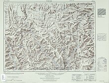
Weixi Lisu Autonomous County
Appearance
Weixi Lisu Autonomous County | |
|---|---|
| Name transcription(s) | |
| • Chinese | 维西傈僳族自治县 |
| • Tibetan | འབའ་ལུང་ལི་སུའུ་རིགས་རང་སྐྱོང་རྫོང། |
| • Lisu | ꓪꓰꓲ-ꓫꓲꓸ ꓡꓲ-ꓢꓴ ꓫꓵꓽ ꓝꓲꓸ ꓛꓬꓽ ꓫꓯꓽ |
 Location of Weixi County (red) in Diqing Prefecture (pink) within Yunnan | |
| Coordinates: 27°12′58″N 99°15′58″E / 27.216°N 99.266°E | |
| Country | China |
| Province | Yunnan |
| Autonomous prefecture | Diqing |
| County seat | Baohe |
| Area | |
• Total | 4,661 km2 (1,800 sq mi) |
| Population (2020 census)[1] | |
• Total | 146,363 |
| • Density | 31/km2 (81/sq mi) |
| Time zone | UTC+8 (CST) |
| Postal code | 674600 |
| Area code | 0887 |
| Website | weixi |
| Weixi Lisu Autonomous County | |||||||
|---|---|---|---|---|---|---|---|
| Chinese name | |||||||
| Simplified Chinese | 维西傈僳族自治县 | ||||||
| Traditional Chinese | 維西傈僳族自治縣 | ||||||
| |||||||
| Tibetan name | |||||||
| Tibetan | འབའ་ལུང་ལི་སུའུ་རིགས་རང་སྐྱོང་རྫོང། | ||||||
| |||||||
| Lisu name | |||||||
| Lisu | ꓪꓰꓲ-ꓫꓲꓸ ꓡꓲ-ꓢꓴ ꓫꓵꓽ ꓝꓲꓸ ꓛꓬꓽ ꓫꓯꓽ | ||||||

Weixi Lisu Autonomous County[a] is an autonomous county of Diqing Tibetan Autonomous Prefecture, in northwest Yunnan province, China. The titular ethnic group is the Lisu people.
Administrative divisions
[edit]Weixi Lisu Autonomous County has 3 towns and 7 townships.[2]
Towns
[edit]Townships
[edit]Climate
[edit]| Climate data for Weixi, elevation 2,326 m (7,631 ft), (1991–2020 normals, extremes 1981–2010) | |||||||||||||
|---|---|---|---|---|---|---|---|---|---|---|---|---|---|
| Month | Jan | Feb | Mar | Apr | May | Jun | Jul | Aug | Sep | Oct | Nov | Dec | Year |
| Record high °C (°F) | 23.0 (73.4) |
23.2 (73.8) |
26.2 (79.2) |
28.0 (82.4) |
31.1 (88.0) |
31.9 (89.4) |
30.9 (87.6) |
31.1 (88.0) |
30.5 (86.9) |
27.2 (81.0) |
23.1 (73.6) |
21.3 (70.3) |
31.9 (89.4) |
| Mean daily maximum °C (°F) | 12.7 (54.9) |
13.7 (56.7) |
15.6 (60.1) |
18.5 (65.3) |
22.1 (71.8) |
25.0 (77.0) |
24.9 (76.8) |
24.7 (76.5) |
23.2 (73.8) |
20.3 (68.5) |
17.1 (62.8) |
14.4 (57.9) |
19.3 (66.8) |
| Daily mean °C (°F) | 4.2 (39.6) |
5.8 (42.4) |
8.2 (46.8) |
11.4 (52.5) |
15.3 (59.5) |
18.7 (65.7) |
18.9 (66.0) |
18.4 (65.1) |
16.9 (62.4) |
12.8 (55.0) |
8.1 (46.6) |
5.0 (41.0) |
12.0 (53.6) |
| Mean daily minimum °C (°F) | −1.6 (29.1) |
0.3 (32.5) |
3.0 (37.4) |
6.4 (43.5) |
10.3 (50.5) |
14.3 (57.7) |
15.3 (59.5) |
14.8 (58.6) |
13.4 (56.1) |
8.3 (46.9) |
2.2 (36.0) |
−1.3 (29.7) |
7.1 (44.8) |
| Record low °C (°F) | −8.0 (17.6) |
−6.8 (19.8) |
−2.8 (27.0) |
−0.1 (31.8) |
4.3 (39.7) |
8.4 (47.1) |
9.5 (49.1) |
9.3 (48.7) |
2.7 (36.9) |
−0.3 (31.5) |
−3.3 (26.1) |
−8.9 (16.0) |
−8.9 (16.0) |
| Average precipitation mm (inches) | 30.5 (1.20) |
59.2 (2.33) |
105.1 (4.14) |
76.3 (3.00) |
66.6 (2.62) |
73.9 (2.91) |
180.5 (7.11) |
168.4 (6.63) |
97.6 (3.84) |
52.9 (2.08) |
17.4 (0.69) |
8.2 (0.32) |
936.6 (36.87) |
| Average precipitation days (≥ 0.1 mm) | 5.8 | 7.6 | 13.6 | 15.0 | 13.5 | 15.0 | 22.0 | 21.9 | 17.4 | 11.0 | 3.9 | 1.9 | 148.6 |
| Average snowy days | 4.0 | 3.5 | 1.6 | 0.1 | 0 | 0 | 0 | 0 | 0 | 0 | 0.2 | 0.9 | 10.3 |
| Average relative humidity (%) | 57 | 62 | 67 | 69 | 69 | 71 | 79 | 80 | 79 | 75 | 65 | 55 | 69 |
| Mean monthly sunshine hours | 212.0 | 181.4 | 173.3 | 160.3 | 159.5 | 138.7 | 122.6 | 125.2 | 115.9 | 167.0 | 212.5 | 229.7 | 1,998.1 |
| Percent possible sunshine | 64 | 57 | 46 | 42 | 38 | 34 | 29 | 31 | 32 | 47 | 66 | 71 | 46 |
| Source: China Meteorological Administration[3][4] | |||||||||||||
Notes
[edit]References
[edit]- ^ "迪庆州第七次全国人口普查主要数据公报" (in Chinese). Government of Diqing Prefecture. 2021-05-27.
- ^ "国家统计局" (in Chinese). National Bureau of Statistics of the People's Republic of China. Retrieved 2021-12-07.
- ^ 中国气象数据网 – WeatherBk Data (in Simplified Chinese). China Meteorological Administration. Retrieved 9 April 2023.
- ^ "Experience Template" 中国气象数据网 (in Simplified Chinese). China Meteorological Administration. Retrieved 9 April 2023.
